La Carbonera: The World's Largest Wax Palm Forest, Just Above Salento
How to visit La Carbonera from Salento — home to hundreds of thousands of wax palms and almost no tourists. By 4x4, mountain bike or on foot. Local tips.
By FabioSalentoLast verified: August 202613 min
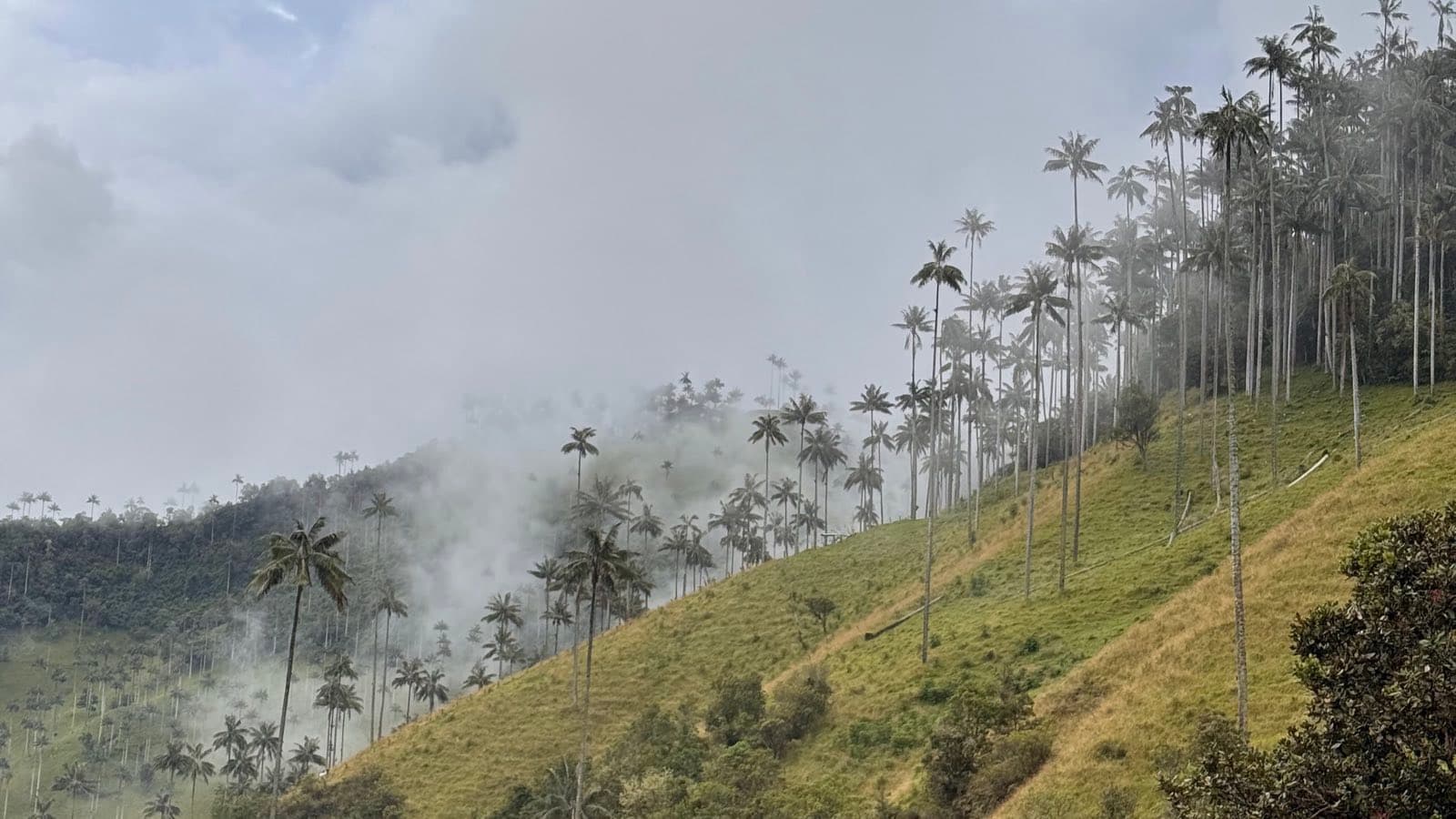
Everyone comes to Salento for the Cocora Valley. Very few know that a couple of hours down a dirt road, there's a valley where the wax palms aren't counted in thousands but in hundreds of thousands — and where you can easily spend a whole morning without crossing paths with another traveler. It's called La Carbonera, the same palm landscape people on the Tolima side call Tochecito, and it's a one-of-a-kind spot, full of parrots, birds and other creatures. If you're already traveling this region, we think you shouldn't miss it.
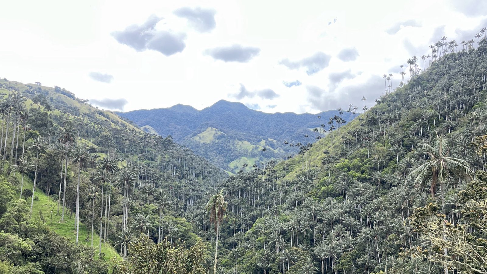
La Carbonera at a glance
- Altitude
- ~2,900 m at the vereda, ~3,300 m at the pass
- Distance
- ~30 km from Salento, along the old road to Toche
- Getting there
- 2–3 hours by 4x4. No public transport at all
- Cost
- Depends on group size and whether lunch is included — ask us on WhatsApp
- Weather
- Cold and humid. Rain gear is not optional
- Money
- Cash only. No shops, no signal
What is La Carbonera? (And is it the same as Tochecito?)
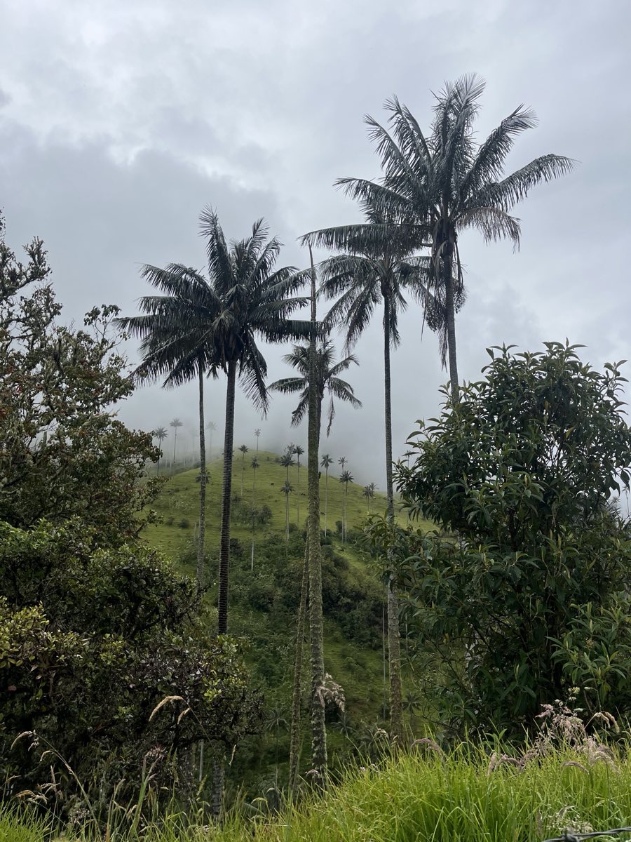
It's a rural district on the ridge of the cordillera, between Salento and the village of Toche, Tolima, at about 2,900 meters. Here grows what's considered the largest concentration of wax palms in existence: entire hillsides carpeted with Colombia's national tree, fog rolling in and out, and — our favorite part — no lines for photos and no hundreds of people making noise.
Yes, La Carbonera and Tochecito are the same landscape, and the two names cause a lot of confusion online. La Carbonera is the name of a finca and the vereda around it, used from the Salento side — the valley where charcoal was once made. Tochecito is the river that runs down to the village of Toche, and it's the name people use from Ibagué. Same palms, same forest, two doors into it.
The tree itself is Ceroxylon quindiuense, the world's tallest palm at over 60 meters. Humboldt and Bonpland described it for science in 1801 along the old Quindío Road — the same historic Salento–Ibagué route the tours still use today. It's been Colombia's national tree since Law 61 of 1985.
How many wax palms are there, really?
Somewhere between 256,000 and 600,000 adult palms, depending on which census you trust — and that honest range is more useful than any single number you'll read elsewhere.
Here's why the figures wander. A peer-reviewed survey of the Tochecito basin puts the count at 256,158 adults (Jiménez, 2017) at the low end and around 600,000 (Bernal et al., 2015) at the high end. The Humboldt Institute's more recent working figure for the wider Tochecito landscape is roughly 300,000 adult palms — still the largest known population of the species anywhere.
Travel blogs repeat numbers that flatly contradict each other, usually without saying where they came from. We'd rather tell you the truth: nobody has counted every palm on those slopes, the estimates disagree, and every one of them is enormous. For comparison, published counts for Cocora run to a few thousand at most. You are looking at a difference of two orders of magnitude, not a marketing claim.
New in 2026: La Carbonera is now a protected sanctuary
In August 2026, Colombia declared the Palmares de Tochecito Flora Sanctuary — 1,964 hectares between Cajamarca and Ibagué, in Tolima, protecting the most important concentration of wax palms in the country: more than 70% of Colombia's recorded population, across ecosystems from roughly 2,000 to 3,750 meters. It became the 66th protected area in the national parks system, and it's barely been covered in English so far.
For you as a visitor, this changes little today and probably a fair amount over the years: the forest now has real legal protection, and access will likely get more formalized over time. We'll update this guide when it does — that's what the "last verified" date at the top is for.
The valley sat inaccessible for decades during the armed conflict, and that isolation unintentionally spared it from the grazing and logging that thinned palm stands elsewhere. Wax palms can't regenerate in open pasture — seedlings need shade, and die from sun or trampling. Cocora's palms are an aging population; Carbonera's forest still grows its replacements.
La Carbonera vs. Cocora Valley
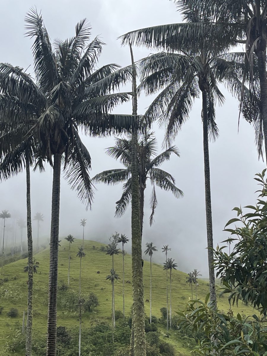
An honest comparison with the Cocora Valley: in Cocora you get the famous photo with the valley behind you, plenty of places to eat, cafés, restaurants, horses, a lot of cars, and a whole tourism infrastructure around it. It's still beautiful, but for some it can feel a little chaotic. La Carbonera, on the other hand, offers more nature, silence, a more intimate experience, and the feeling of having found something not everyone knows about.
Both are worth seeing — but if you've already done Cocora, La Carbonera is a plan you shouldn't miss.
| La Carbonera | Cocora Valley | |
|---|---|---|
| Wax palms | 256,000–600,000 adults | A few thousand at most |
| Crowds | You may see nobody all morning | Hundreds of visitors on a good day |
| Cost | Private tour, split by group size | ~$5,000 COP each way by jeep |
| Access | 2–3 h by 4x4, no public transport | Willys jeeps every 20–30 min from the square |
| Infrastructure | Almost none — no shops, no signal | Restaurants, cafés, horses, toilets |
| Best for | Silence, forest, going deeper | The classic photo, an easy first day |
How to get to La Carbonera from Salento
Keep in mind this is an unexplored destination, which means there's no public transport that gets you up there. Here are the four ways up.
By 4x4 tour (the easy way)
Half a day along the old road to Toche in high-clearance 4x4s. It's the most comfortable option and the one we recommend to most people: someone else handles the potholes, you get the viewpoints, and there's a snack stop at a finca on the way. Ask us at reception or on WhatsApp and we'll arrange it.
By mountain bike (our favorite)
A pickup carries you and the bikes to the top of the mountain, and from there you ride back down under your own steam — nearly 1,000 meters of descent on dirt track, through guadua and coffee farms, then cloud forest, then the first palms poking out above the trees. It is easily one of the most unique things you can do on a bike in Colombia.
There are two routes: the classic descent on the main road, which most reasonably fit people can handle, and a much narrower singletrack with rocks, mud and tight switchbacks for experienced riders. Fabio rode it and wrote the whole day up first-hand — the itinerary stop by stop, both routes, what's included, what it costs and what to bring.
→ Read his first-person account: La Carbonera by mountain bike.
On horseback or on foot
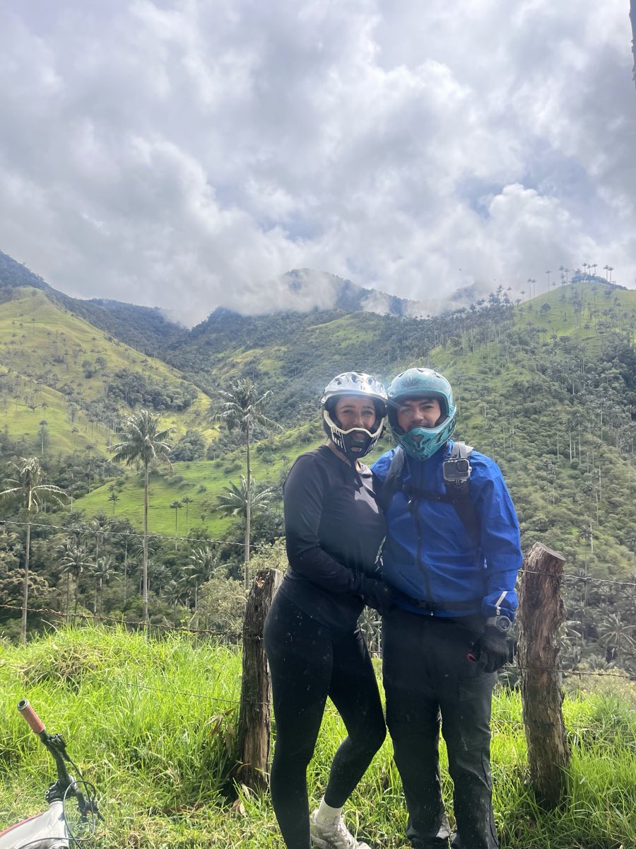
The slowest versions, and the ones where you actually learn the landscape. On horseback you cover the distance without engine noise, which changes what you hear — this is a forest full of birds, and you notice that immediately. On foot, the walking is long and the altitude is real: time and legs required, not a casual afternoon. Either way take a local guide. The tracks branch, the fog closes in fast, and there's no signal to look anything up.
Driving yourself: read this first
Nothing stops you from driving up yourself, but the road is a dirt track with potholes, big rocks and some very steep sections. After rain, parts of it turn to mud. Rent a high-clearance 4x4, and if you're not confident in those conditions, the safest bet is a local guide who knows the area and the best viewpoints.
One thing self-drivers get wrong: the fincas up there are private land. There is often no gate and nobody standing at the roadside, and that is not an invitation. Seek out the owners, say hello, and pay the entrance fee. These are working farms whose families have kept this forest standing, and the visitors who behave well are the reason the next ones get let in.
And this is the valley seen from the road, up at Alto de Toche:
What you'll see along the way
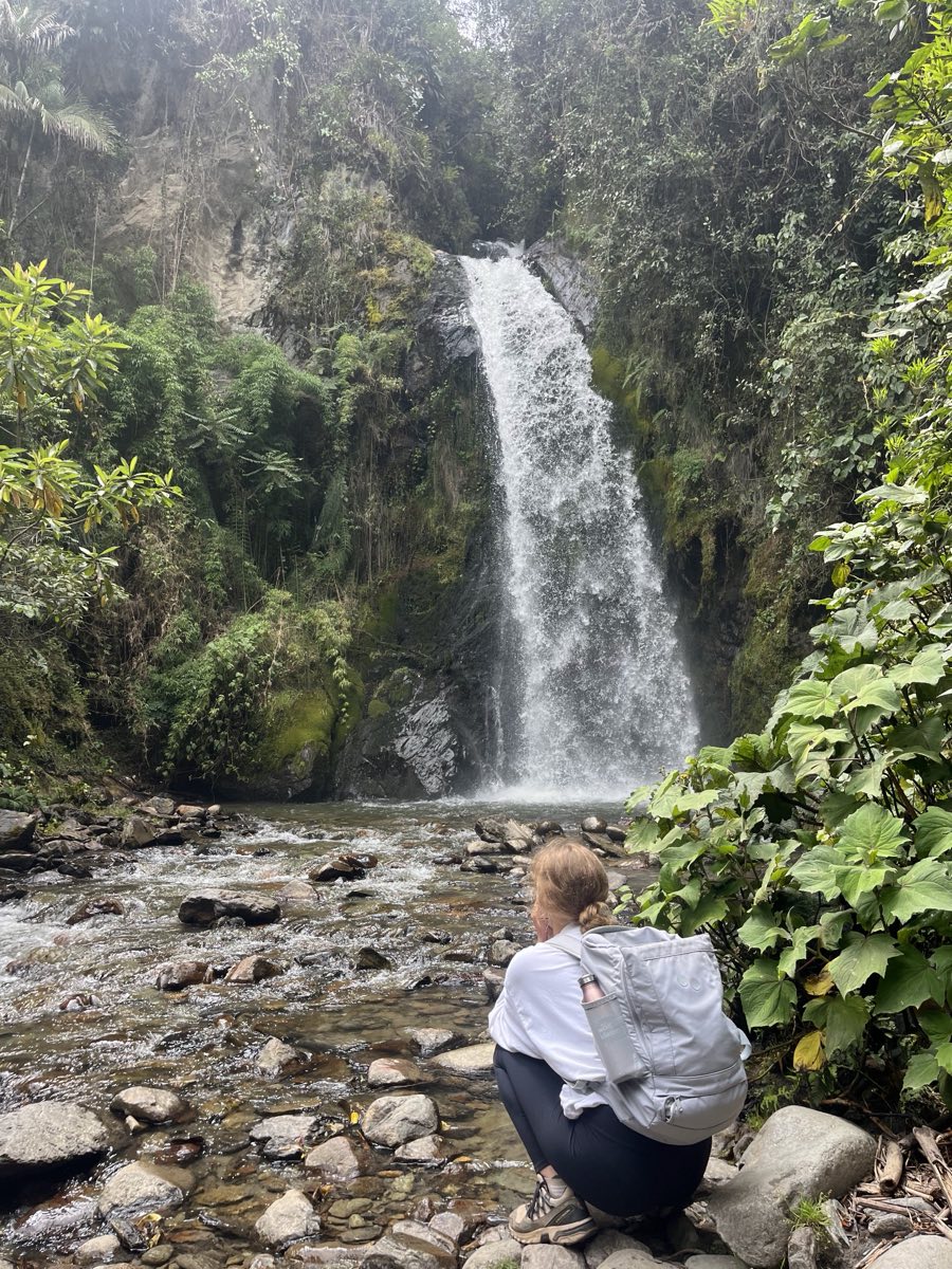
La Carbonera isn't a single viewpoint — it's a full day of stops. Along the road there are waterfalls tucked into the cloud forest, a few meters off the track, perfect for stretching your legs and putting a hand in the water (freezing, but refreshing). Our tour sets aside time to visit one of them.
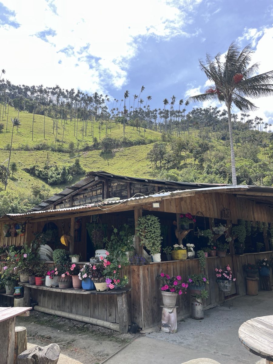
We also stop at a wooden farmhouse, full of potted plants and flowers, where we serve you a coffee or an agua panela with the most beautiful view in the Coffee Region right in front of you. If you're going on your own, don't count on them being open — they often work by reservation only. If you're lucky and find them open, don't hesitate to stop a while and try what our Colombian campesinos make.
The parrot on our logo lives here
That green bird on our logo is a loro orejiamarillo — the yellow-eared parrot, Ognorhynchus icterotis — and this is his forest. We didn't pick him for decoration.
He is about as tied to the wax palm as a bird can be: he nests almost exclusively in them, roosts in them, feeds around them. When the palms go, he goes. And he nearly did — by the late 1990s the species was feared extinct, until a 1999 survey in Colombia turned up 81 birds.
What happened next is the good news you rarely get in conservation. Twenty-odd years of nest protection, palm planting and work with the families who live among these palms pulled the population back over a thousand adults, and BirdLife now lists it as Vulnerable with an increasing trend — still fragile, no longer disappearing.
So when you're standing on that ridge and something loud and green goes over, that's him. The clip below is one we filmed up there.
How much does a La Carbonera tour cost?
Price depends on how many people are in the group and whether lunch is included. A private 4x4 split between four is a very different number from the same truck carrying two, so we quote per group rather than pretend there's one sticker price.
| Tour | What's included | Price |
|---|---|---|
| 4x4 day tour | Transport, local guide, snack at the finca | Depends on group size — ask us |
| MTB tour | The above, plus bike, helmet, gloves and insurance | Depends on group size — ask us |
Our first-person write-up of the MTB descent has the current per-person price and everything the day includes.
Message us on WhatsApp at +57 310 5053160 and we'll arrange it for whatever dates you want — and tell you honestly if the weather that week makes another plan smarter.
Best time to visit & what to bring
Start early. This is the one that matters. The afternoon fog is beautiful, and it also hides the palms exactly when you wanted the photo. Morning departures see the valley; afternoon departures see cloud.
Expect rain. It rains up there fairly often, whatever Salento's sky is doing when you leave. A rain jacket is not optional.
Dress for 1,000 meters higher than Salento. The weather turns in minutes — and it's the damp kind of cold that gets into you while you stand still for photos.
What to bring:
- Rain jacket or poncho — genuinely mandatory, not a suggestion
- Warm layers, and a change of socks if you're cycling
- Cash in small bills: no shops, no card machines, no signal up there
- Closed shoes with grip; the track is mud after rain
- A good breakfast before you leave — the snack stop is a snack, not lunch
- Camera, and something to keep it dry
FAQ
Is La Carbonera worth it if I've already done Cocora Valley?
Yes — and honestly it's the better order. Cocora gives you the classic photograph; La Carbonera gives you the forest that photo is a small sample of, with a hundred times the palms and almost none of the people. If you only have time for one and you've done neither, do Cocora. If you've done Cocora, this is the obvious next step.
Can you visit La Carbonera without a tour?
You can, but you'll need your own high-clearance 4x4 — there is no public transport, no shuttle and no jeep service to La Carbonera. The road is rough dirt and turns to mud after rain. Also remember the fincas are private land: find the owners and pay the entrance fee rather than wandering in through an open gate.
How long does a La Carbonera trip take?
Budget half a day to a full day. It's about 30 km from Salento but 2–3 hours each way by 4x4, because the road is a dirt track the whole way. Most people leave early in the morning and are back in Salento by mid-afternoon, which also gets you the clearest views before the fog closes in.
How hard is the mountain bike route?
The classic descent follows the main dirt road and suits most reasonably fit riders — it's downhill, but 1,000 meters of loose surface still demands attention and working brakes. The extreme singletrack route is for experienced riders only. Both are covered in detail in our Salento mountain biking guide.
Is La Carbonera safe to visit?
Yes. The valley was isolated during the armed conflict years, but that's history — it's now a declared flora sanctuary and a normal rural area of working fincas. The real risks are ordinary mountain ones: the road, the weather, the altitude and no phone signal. Go with someone who knows the route and they stop being risks.
What's the difference between La Carbonera and Tochecito?
They're two names for the same palm landscape. La Carbonera is the finca and vereda name used on the Salento side, in Quindío; Tochecito is the river and valley name used from the Ibagué side, in Tolima. The new flora sanctuary uses the Tochecito name, which is why you'll see both in the news.
La Carbonera is the star of day 4 in our 5-day Salento itinerary. If you're coming with time to spare, book your room and we'll help you arrange the whole plan. Any other question, or want a hand with your bookings? Write to us.